|
GIS is a computer system for capturing, storing, checking, integrating, manipulating, analysing and displaying data related to positions on the Earth's surface. Typically, a Geographical Information System is used for handling maps of one kind or another. These might be represented as several different layers where each layer holds data about a particular kind of feature. Each feature is linked to a position on the graphical image on a map and a record in an attribute table. GIS can relate otherwise disparate on the basis of common geography, revealing hidden patterns, relationships, and trends that are not readily apparent in spreadsheets or statistical packages, often creating new information from existing data resources.
To achieve this, a project proposal to develop a GIS program for HMC area was initiated in 2002. For the first time in West Bengal a GIS project was supported by funds allotted by Sri Swadesh Ranjan Chakraborty, Hon'ble Member of Parliament, Howrah from his MPLAD programme.
In a list of project objectives and a subsequent achievable outcomes were drawn up.
Objectives:
1. To establish a GIS/MIS database in all 50 wards of the Corporation for provision of online services for the people initially through a server based system.
2. To provide up to date information to each citizen on key informations such as status of individual taxes, approval of building plans, etc.
3. To reduce delays in the issuance of birth and death certificates, payment of taxes, etc. to monitor flow of funds, ensure efficient use of resources and timely submission of utilisation certificates.
4. To prepare perspective plans, annual plans with priority to the social sectors like education, health, nutrition, water, sanitation, etc.
5. To identify households and areas where there are gaps in service delivery and to take appropriate action for ensuring greater utilisation of services.
Expected project outcomes:
1. Greater efficiency of service delivery
2. Enhanced transparency of decision making
3. Reduction in delays in service delivery.
4. Response to citizens.
5. Better targetting of services to disadvantaged groups and families.
6. Better management and optimum utilization of municipal staff and equipment.
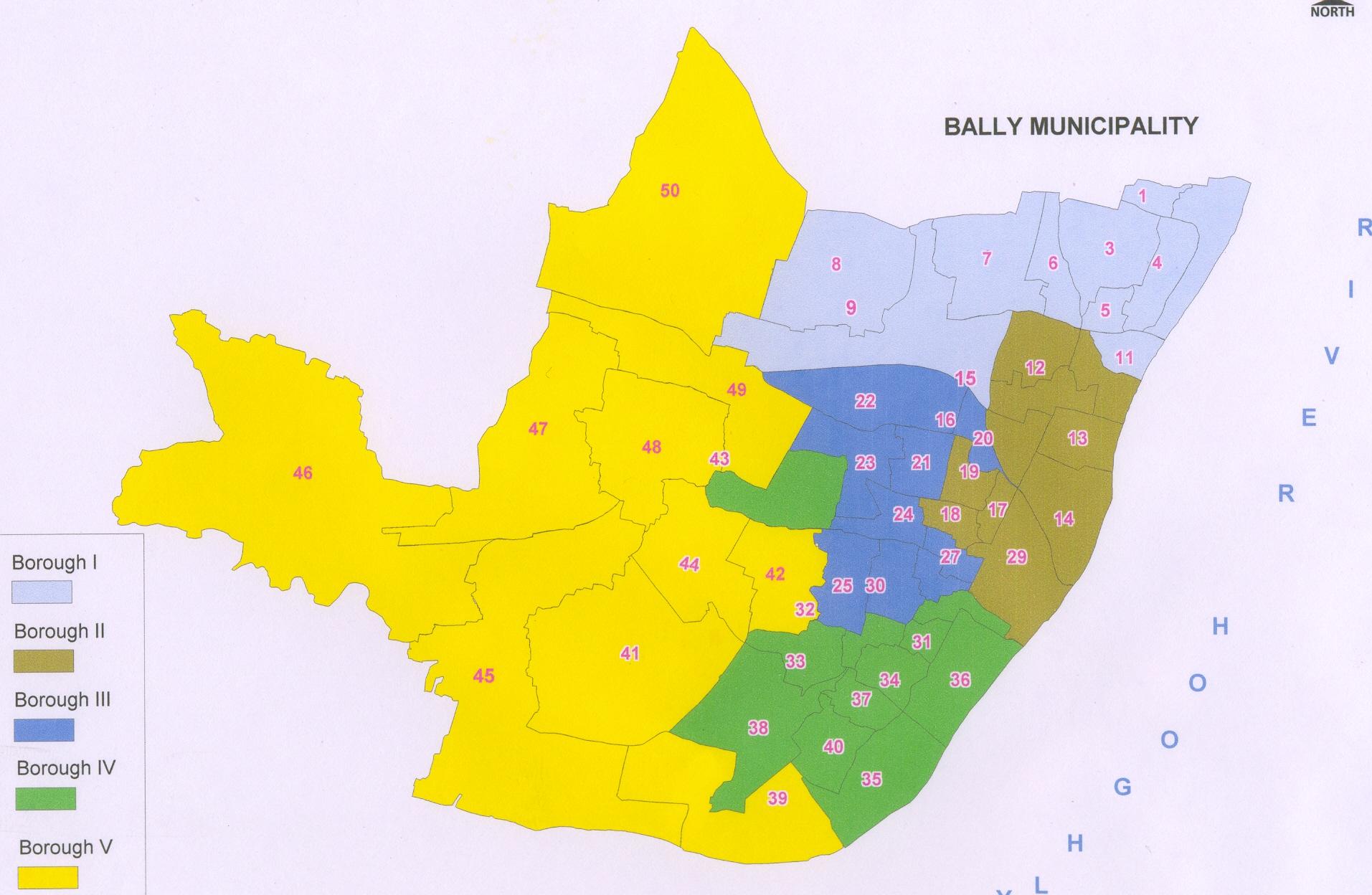
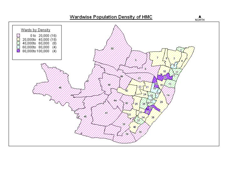
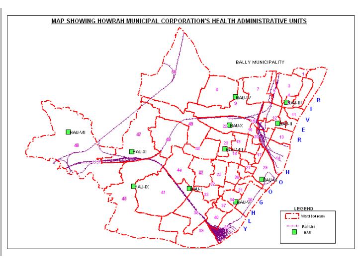
GIS maps have been generated showing ward boundaries, roads, important places, infrastructure, water bodies, etc. These maps are already being utilized by various organisations like HIT, KMWSA, KUSP programme, HMC Engineering Dept., etc.
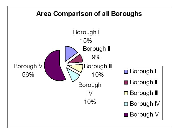
Some GIS maps are shown below:
HMC MAP SHOWING THE WARDS UNDER EACH BOROUGH

|


